 |

Submitted by , posted on 07 February 2001
|
 |
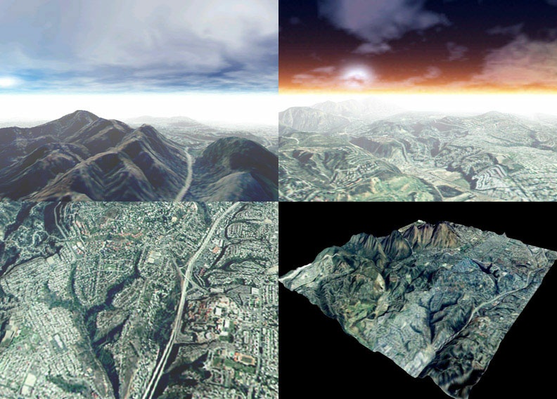
Image Description, by

Here is a screen shot of a program I wrote for an OpenGL class at San Diego
State University. The terrain shown is actually a representation of the
real terrain near the university. The elevation data was taken from USGS
.DEM files and then textured with actual aerial photographs (not satellite)
of the same region. The hardest part of the whole thing was getting the
textures to line up with the elevation data - some of them had to be
tweaked/skewed/stretched in an image manipulation program to more
accurately line up with the elevations. In the top left picture you see
Cowles Mt as seen from the north (in Santee), with Mission Gorge Rd. The
bottom left picture is Highway 8 as seen from above, with San Diego State
off to the right (you can just make out the track and field) The overpass
in the center is College Ave. The bottom right picture shows the entire
region (elevation exaggerated, no fog) and in it you can see Cowles Mt.,
Highway 8, and Lake Murray. I sent this screenshot to a few local pilots
and gotten good reactions from them. Hope you all like it. : )
Any questions about it can be directed to maynard@rohan.sdsu.edu (though
I'm not sure how long the account will remain active now that I've
graduated...)
|
|